

I decided to poke some fun at this zany city with my own version of the neighborhood names and stations served by the City of Angels’ fine subway system, otherwise known as the Mass Rapid Transit (MRT).
Below you’ll find the MRT’s official system map, followed by my satirical versions.
Enjoy!
For anyone not in the know, the MRT is Bangkok’s subway system. As for now – but hopefully not too much longer as construction of extensions continue – the entire route is shaped like a backwards “C” that stretches from Bang Sue in the north, down to Hua Lamphong in the south.
It’s a lovely creature with just the right level of air-con and spotlessly clean stations.
Here’s the official map:
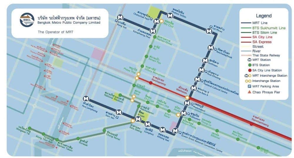
Via Bangkok Metro
But after four years in Bangkok, here’s my version of what you can expect to find along the MRT route.
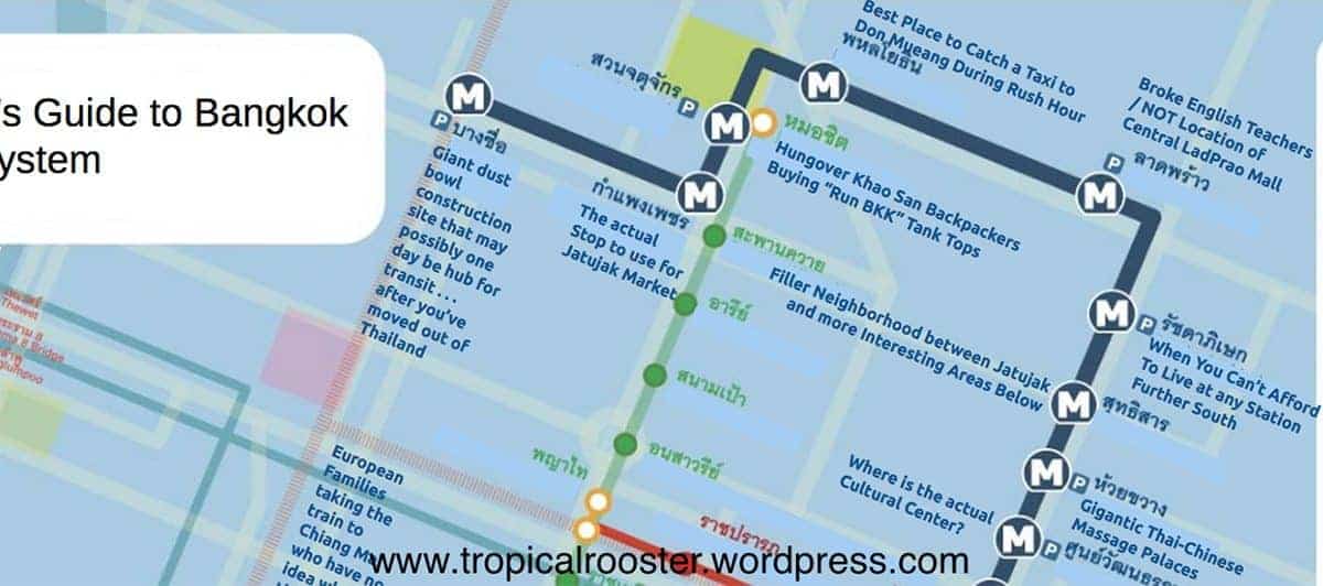
Let’s start with the top half of the map.
For a lot of foreigners, this might be a mysterious zone, save for Jatujak – home to Jatujak market, of course.
But for the intrepid who go off the beaten Sukhumvit path, you’ll be rewarded with funky night markets paired with much less painful rents.
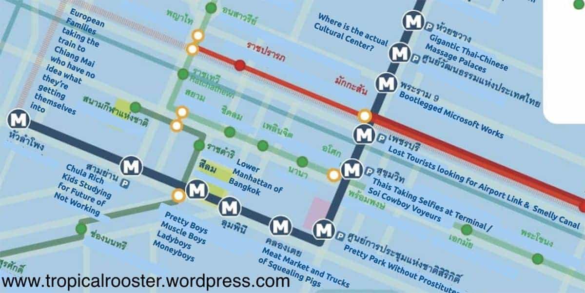
And here’s the bottom half of the system.
It’s starts with Petchaburi station, which I jokingly consider to be the ‘farang frontier’ of Bangkok. A gradual increase in the proportion of tourists sporting elephant-print pants takes place with each consecutive station south.
The tourists, and subway itself, culminate at the Hua Lamphong terminus. From here, it’s a mess of lost people looking for (a) Chinatown, (b) The Grand Palace, or (c) an ‘express’ ticket to Chiang Mai.
Here’s the full image of the whole parodied system, just in case you like a general overview and are blessed with superhero-style vision:
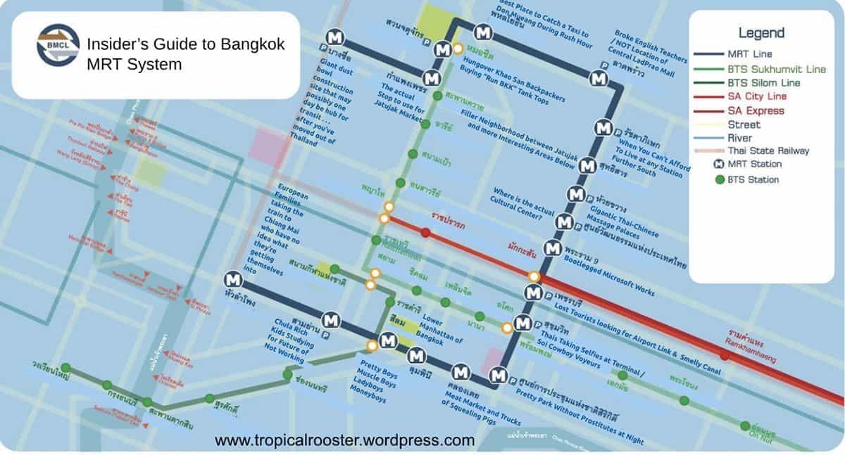
And just in case you prefer a good list, here’s a recap of the stations and their parodied equivalents:
- Bang Sue: Giant Dust Bowl Construction Site That May, Possibly, One Day, Be A Hub For Transit… After You’ve Moved Out Of Thailand
- Kamphaeng Phet: The Actual Stop To Use For Jatujak Market
- Chatuchak Park: Hungover Khao San Backpackers Buying “Run BKK” Tank Tops
- Phahon Yothin: Best Place To Catch A Taxi To Don Mueang During Rush Hour
- Lat Phrao: Broke English Teachers // NOT The Location of Central Ladprao Shopping Mall
- Ratchadaphisek: When You Can’t Afford To Live At A Station Further South
- Sutthisan: Filler Neighbourhood Between Jatujak And More Interesting Areas Below
- Huai Khwang: Gigantic Thai-Chinese Massage Palaces
- Thailand Cultural Centre: Where Is The Actual Cultural Centre?
- Phra Ram 9: Bootlegged Microsoft Works
- Phetchaburi: Lost Tourists Looking For Airport Link + Smelly Canal
- Sukhumvit: Thais Taking Selfies At Terminal 21 // Soi Cowboy Voyeurs
- Queen Sirikit National Convention Centre: Pretty Park Without Prostitutes At Night
- Khlong Toei: Meat Market And Trucks Of Squealing Pigs
- Lumphini: Lower Manhattan Of Bangkok
- Si Lom: Pretty Boys, Ladyboys, Muscle Boys, Money Boys
- Sam Yan: Chula Rich Kids Studying For A Future Of Not Working
- Hua Lamphong: European Families Taking The Train To Chiang Mai Who Have No Idea What They’ve Got Themselves Into
What’s your take on what’s really lurking around each station of the MRT?
These maps were originally published on Let’s Get Tropical: Bangkok